 Pro
ProProperty Ownership Maps
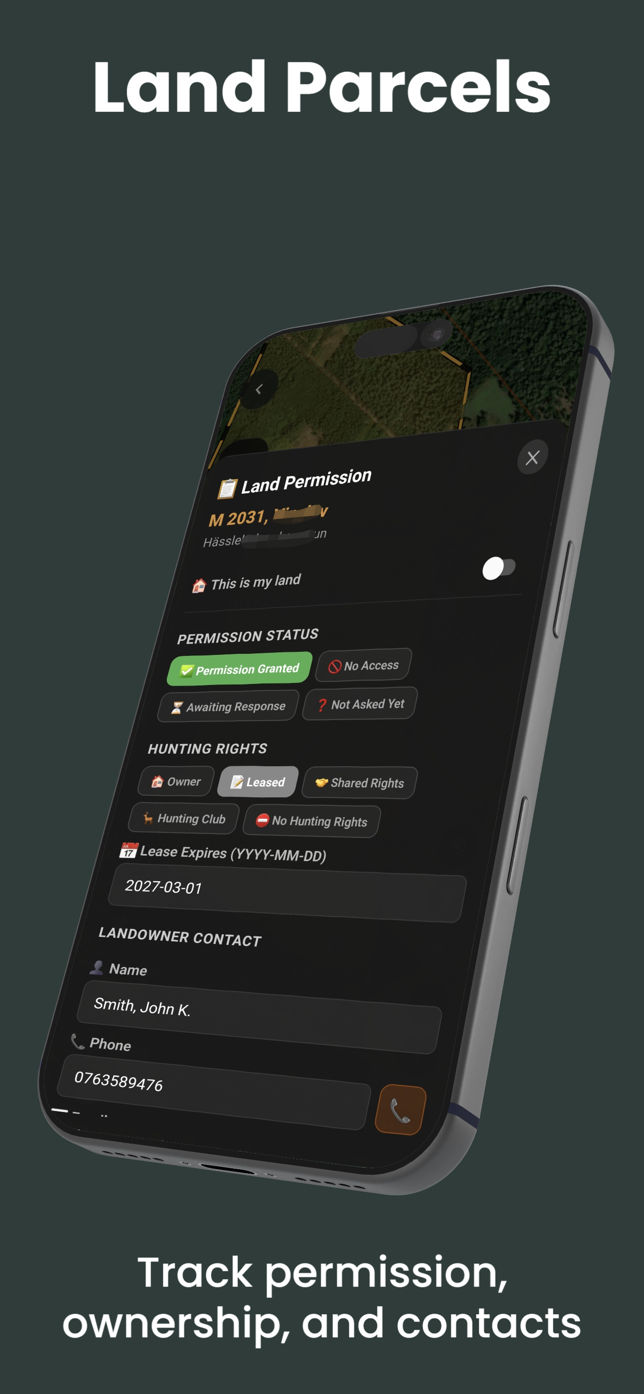
The Land Parcels layer displays recorded parcel boundaries and, where available, ownership information directly on your hunting map. Know where public land ends and private property begins — before you take a single step into the field.
The Land Parcels layer requires a Pro subscription. Property and cadastral coverage is in active development and is not yet available in all countries; where covered, the layer can be downloaded for offline use.
Why Property Ownership Matters
Trespassing is one of the most serious legal risks a hunter faces. Property boundary lines are rarely marked in the field — fences, streams, and ridgelines seldom align with legal parcel lines. ProHunt puts legally recorded boundaries on your phone so you can hunt confidently, legally, and ethically.
Knowing ownership also opens doors. When you spot a great piece of terrain on satellite imagery, ownership information — where available — can help you decide whether to seek written permission to hunt it.
What the Layer Shows
- Parcel boundary lines — outlines for recorded parcels where data is available
- Ownership information — shown where available for a parcel (varies by region and data source)
- Parcel size — shown where available
- Land classification — such as private or public land, where the data source provides it
Country Coverage
Property and cadastral coverage is in active development and is not yet available in every country. Availability and the level of detail (boundaries, and ownership information where available) vary by region and data source. Open the layer in your area to see current coverage.
ProHunt’s hunting regulations cover 22 countries. That figure applies to regulations only — property/parcel coverage is a separate dataset that is still expanding.
Using Property Data for Permission Knocking
Scout terrain on satellite imagery
Find food sources, funnels, and bedding areas using ProHunt satellite and LiDAR layers.
Enable the Land Parcels layer
Turn on the overlay to identify which parcel contains your target area, where coverage is available.
Check available ownership information
Tap the parcel to see any ownership information the data source provides for your area.
Confirm through official sources
To identify and contact a landowner, verify details with the relevant land registry or assessor for your jurisdiction.
Approach respectfully
Arrive in daylight, dressed neatly, with no firearms visible. Offering to show your planned hunt area on the ProHunt map demonstrates preparation and respect and improves permission success rates.
Cadastral data can lag behind recent surveys, sales, and boundary adjustments. For critical legal decisions, always verify with the county assessor, land registry, or equivalent official authority. ProHunt data is for navigation guidance only and does not constitute legal authorisation to enter any property.
Best Practices
- Download the property layer offline for your hunting area before leaving cell coverage
- Cross-reference with the Public Land Boundaries layer to clearly distinguish private from public
- Once you have written permission, draw the permitted boundary using the Map Drawing tool so all team members know exactly where they can be
- Mark property corners as waypoints to help you stay on the right side of the line in the field
Frequently Asked Questions
- Is property data available everywhere?
- No. Property and cadastral coverage is in active development and is not yet available in all countries. Open the layer in your area to see current coverage. Boundaries may lag behind the current registry, so verify with official sources for legal decisions.
- Does the layer show if land is open to hunting?
- Where available, it shows parcel boundaries and ownership information. It is not a permission tool — private land always requires landowner permission, and public-land access rules must be confirmed with the relevant authority regardless of what the app shows.
Related Features
- Terrain Layers — full layer overview
- Hunting Regulations — season dates and species rules
- Map Drawing — mark your permitted hunting area
- Offline Maps — download parcel data offline where coverage is available