 Pro
ProMaps
The interactive map is the heart of ProHunt. Every feature in the app — from HuntCast and wind analysis to team tracking and the hunt journal — centres on the map. Understanding the map interface deeply makes you a more effective hunter and a more confident navigator.
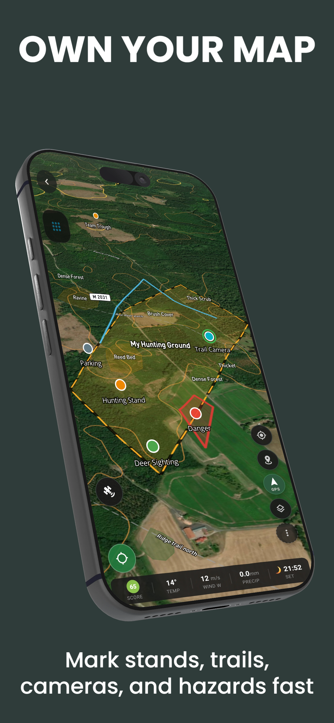
Map Interface Overview
The ProHunt map screen has four zones:
- Map canvas — the main map area. Pan, zoom, rotate, and interact with the map. Your GPS position is shown as a blue dot with an accuracy ring and directional arrow.
- Top toolbar — layer switcher, search, map type selector
- Right toolbar — compass, GPS re-centre, measure tool, 3D toggle, north-up/heading-up toggle
- Bottom navigation bar — access Hunt, Map, HuntCast, Journal, Team, and Settings
Available Map Types
| Map Type | Best Use Case | Plan |
|---|---|---|
| Satellite | Aerial scouting, vegetation identification | Free |
| Hybrid | Navigation with satellite context and road labels | Free |
| Topographic | Terrain reading, contour navigation | Free |
| Dark topo | Low light, reduced eye strain, night use | Free |
| Minimal road | Urban approach and vehicle navigation | Free |
Core Map Tools
Waypoints
Long-press anywhere on the map to drop a waypoint pin. Waypoints save named locations — stands, feeders, parking, gates, water sources — and are always visible regardless of map type or zoom level.
Map Drawing
Draw lines, routes, and polygons directly on the map. Use for drive routes, property boundaries, firing lanes, and hunt area outlines.
Points of Interest
Pre-loaded and user-added points for logistics — hospitals, boat ramps, fuel, check stations, and emergency services.
Water Sources
Rivers, ponds, springs, and seasonal water identified on the map. Critical for locating game during hot or dry periods.
GPS and Navigation
Your GPS position updates continuously as you move. The directional arrow shows your heading based on recent movement (not compass bearing — accuracy improves when walking). Key navigation features:
- Re-centre button — tap the location icon to snap the map back to your current position after panning
- Heading-up mode — rotates the map so your direction of travel is always at the top (like a car GPS). Tap the compass icon to toggle between north-up and heading-up.
- GPS accuracy ring — the blue circle around your position shows the GPS uncertainty radius. A small ring means good accuracy (<10m); a large ring means reduced accuracy.
- Altitude display — your current elevation is shown in the HUD overlay, derived from GPS with barometric correction when available.
Measuring Distances
Tap the ruler icon in the right toolbar to enter measuring mode. Tap a series of points on the map to measure a path or calculate the area of a polygon. Useful for:
- Estimating how far you walked from the truck to a stand
- Measuring legal distance from a road or building for safety zone compliance
- Calculating the acreage of a food plot or hunting parcel
Map Search
Tap the search icon in the top toolbar to search for:
- Place names, addresses, and coordinates
- Your saved waypoints (search by name)
- Public land access points where available
- Nearby services (hospitals, fuel, hotels)
Frequently Asked Questions
- How do I share my location on the map with someone?
- Tap and hold your blue GPS dot to copy your coordinates or generate a share link. The link opens your exact location in Google Maps for anyone who receives it, whether or not they have ProHunt.
- Can I use coordinates (latitude/longitude) to navigate?
- Yes. Paste coordinates into the map search bar in decimal degrees (e.g. 59.3293, 18.0686) or DMS format. The map navigates to that position and drops a temporary marker.
Related Features
- Terrain Layers — all 24 available overlays
- Waypoints
- Map Drawing
- Offline Maps